Project title:
‘Debris-cover on glaciers: Exploring methods to assess climate-induced glacier changes and their impacts’
FUNDING: European Commission Marie-Curie COFUND scheme (2017 – 2020)
PROJECT PI/CO-PI: Neil Glasser and Adina Racoviteanu, Aberystwyth University
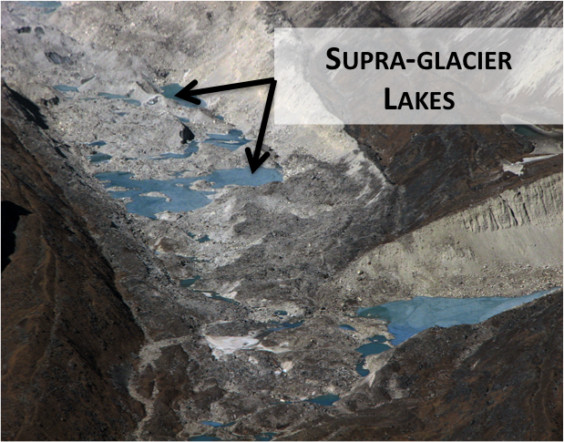
MAIN GOAL: The main goal of this project is to identify rapidly changing glaciers, in particular debris-covered glaciers in the Himalayas using the best available remote sensing techniques (object-oriented mapping), and state-of-the art photogrammetric technology (thermal infrared imagery from unnamed aerial vehicles). This project aims at understanding the evolution of surface features such as exposed ice walls and supraglacial lakes, and their contributions to glacier ice melt and to glacier-related hazards such as Glacier Lake Outburst Flood (GLOF) events. Glacier hazard assessments remain sparse in remote high altitude areas such as those targeted here; combining various techniques techniques will allow us to generate metrics that are needed for hazard assessments.
RESEARCH OBJECTIVES:
- Identify regions of the Himalaya where glaciers and associated lakes have been changing rapidly in the last decade: Using remote sensing, we aim at updating regional maps of debris covered glaciers and lake extents based on semi-automated methods applied to recent Landsat 8 (30m) and Sentinel-2 imagery (10 m) surface reflectance. This will guide the choice of local areas where more detailed analysis will be performed, using higher resolution images.
- Quantify local-scale topographic factors (local slope and orientation) and surface features (ice walls, debris mounds and supraglacial lakes) : We aim at extracting surface features in a automated fashion using feature detection algorithms, applied to Landsat 8 and Sentinel-2 imagery, sub-pixel mapping methods for lake delineation applied to Landsat, on the basis of regions of interest extracted from higher resolution Pleiades imagery and PlanetScope very high resolution daily imagery (0.8 – 5 m) [1].
- Assess the hazard potential of selected glacierized basins using an updated hard ranking scheme: We are compiling existing glacier lake hazard-ranking schemes and are aiming at automating existing schemes tested in the Himalayas. We are using a geographic information system (GIS) on the basis of topographic information coupled with glaciological data generated from the first two objectives. to extract moraine characteristics needed for the hazard ranking scheme.

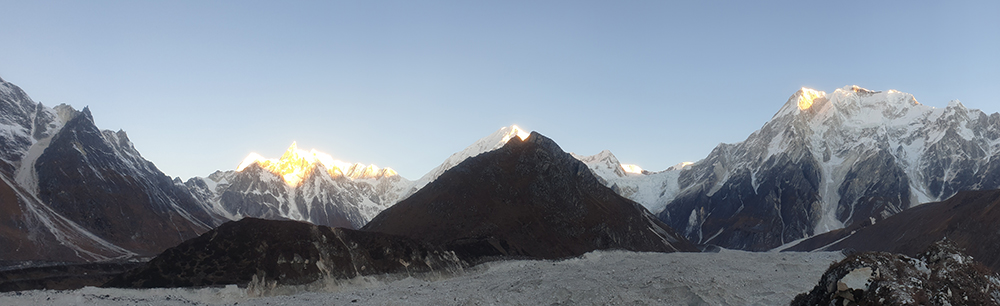
 (above): Surface features on debris covered glaciers in the Khumbu region in the Nepal Himalaya. Photo credit: A. Racoviteanu
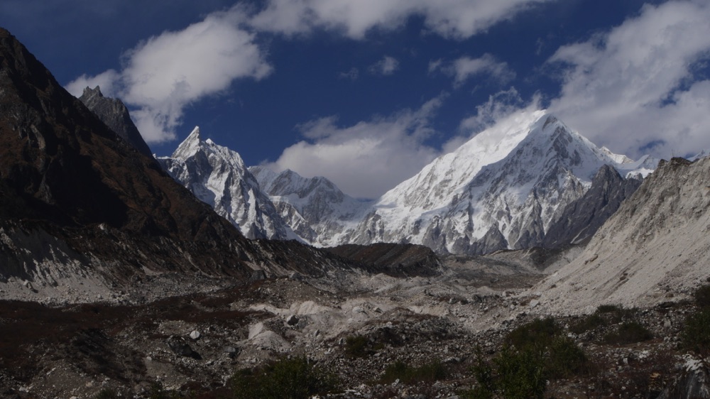
[1] https://www.planet.com/